Blog
Abraham Ortelius – Charting The World
Abraham Ortelius: Pioneer of Modern Cartography
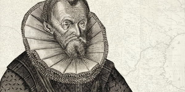
Abraham Ortelius (1527–1598) was a visionary Flemish cartographer, geographer, and antiquarian whose work transformed the way people viewed the world. He is best known for creating the first modern atlas, Theatrum Orbis Terrarum (Theatre of the World), first published in 1570. More than a collection of maps, Ortelius’s atlas was a revolutionary step forward in cartographic science and a defining achievement of the Age of Exploration.
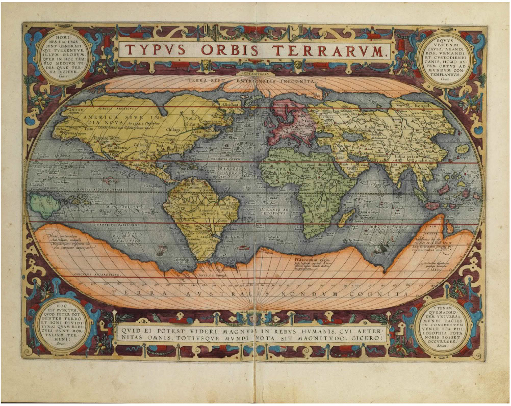
The first modern atlas of the world by Abraham Ortelius, first published in 1570.
Theatrum Orbis Terrarum: The First Modern Atlas
Abraham Ortelius launched Theatrum Orbis Terrarum at a time when the world was expanding rapidly through European exploration. Earlier maps had varied greatly in design, accuracy, and scope. Ortelius brought a new level of order and precision by compiling 53 uniformly designed maps in the first edition of his atlas. Each map was accompanied by explanatory texts that provided historical, geographical, and cultural commentary.
Ortelius’s approach was revolutionary. He sourced maps from various reputable cartographers across Europe and carefully edited them to maintain a consistent visual and thematic style. This not only improved usability but also created a more accurate and cohesive worldview for readers. It was the first time the public had access to a standardized visual representation of global geography in a single, professionally compiled volume.
A Living Document of Discovery and Expansion
Ortelius did not treat his atlas as a static collection. As European navigators and explorers returned with new information about distant lands, he continually updated and expanded the Theatrum Orbis Terrarum. Later editions included up to 167 maps, reflecting the rapidly evolving understanding of the world during the 16th century.
The atlas became an essential tool for scholars, traders, and navigators, serving not only as a map book but also as a compendium of geographical knowledge. It captured the dynamic nature of global exploration and offered a structured view of a world in transformation.
Because of its scope and precision, many consider Theatrum Orbis Terrarum the ultimate summary of 16th-century cartographic knowledge. Its publication in 1570 is widely recognized as the starting point of the Golden Age of Netherlandish Cartography, a period during which the Low Countries emerged as the leading center for mapmaking, geographic research, and printing.
The Influence of Abraham Ortelius on European Cartography
Ortelius’s influence on the cartographic community was immediate and enduring. His work set new standards for mapmakers across Europe. By emphasizing accuracy, consistency, and organization, Abraham Ortelius helped elevate cartography from an artisan’s craft to a scholarly discipline.
His work inspired countless contemporaries and future generations of geographers. Ortelius believed that maps should not only be practical tools but also gateways to understanding the world’s history, politics, and cultures. This interdisciplinary approach shaped the development of modern geographical science.
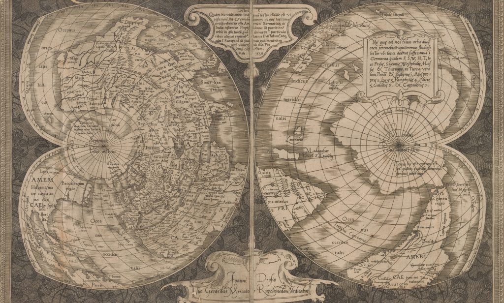
Photo by The New York Public Library on Unsplash
Ortelius’s Enduring Legacy: The Work of Martin Meyer
The impact of Abraham Ortelius extended well beyond his lifetime. Among those who sought to continue his legacy was Martin Meyer, whose work Ortelius Redivivus et Continuatus—translated as “Ortelius Revived and Continued”—paid homage to Ortelius’s groundbreaking contributions.
Unlike the Theatrum Orbis Terrarum, which focused on global geography, Meyer’s work expanded into historical and military mapping, particularly concerning conflicts involving Hungary and the Ottoman Empire. Meyer used Ortelius’s systematic approach as a foundation, then added historical context and strategic insights.
This evolution highlighted how Ortelius’s methods could be adapted to serve specialized audiences and address specific historical themes. Meyer’s tribute serves as a powerful example of how foundational works in any field can inspire further refinement and discovery.
Systematic Cartography: A Legacy of Method and Precision
Ortelius’s method of organizing maps into a consistent and structured format set a new precedent in the cartographic world. He brought together the best available geographic knowledge, arranged it logically, and provided critical commentary. This process laid the groundwork for the systematic approach to atlas-making that continues today.
Modern mapmakers owe a great debt to Abraham Ortelius. His insistence on standardization, accuracy, and scholarly rigor became guiding principles that continue to define cartographic production. His influence helped transition the map from a simple navigational aid to a comprehensive visual tool for understanding global dynamics.
Ortelius and the Humanist Tradition
Abraham Ortelius was not only a mapmaker but also a product of the Renaissance humanist movement. He was deeply interested in history, classical literature, and ancient geography. These interests are evident throughout his work, particularly in the historical annotations and references found in Theatrum Orbis Terrarum.
His fusion of classical knowledge with modern discoveries made his atlas more than a technical achievement—it was a cultural and intellectual milestone. Ortelius showed that geography was not isolated from other disciplines but closely tied to the broader pursuit of human knowledge.
Shaping the Future of Cartography
Abraham Ortelius’s contributions fundamentally changed how people viewed and understood the world. His work signaled a shift toward a more scientific and global perspective, encouraging future generations to explore, document, and interpret the planet with ever-greater accuracy.
In modern times, we see Ortelius’s influence in the way maps are designed, used, and understood. From printed road atlases to interactive digital maps, the principles he established—clarity, consistency, and contextual richness—remain central to geographic information systems (GIS) and mapping technologies today.
Abraham Ortelius in the Digital Age
Even in the digital age, Abraham Ortelius’s name carries immense weight in the world of geography and cartography. Institutions, collectors, and scholars still study his atlases, and original editions of Theatrum Orbis Terrarum are considered valuable, rare books and cultural treasures.
The digitization of Ortelius’s works by museums and libraries ensures that his contributions remain accessible to the public. His maps are frequently exhibited and studied as masterpieces of Renaissance cartography, offering a window into the worldview of 16th-century Europe.
Conclusion: Abraham Ortelius and His Lasting Impact
Abraham Ortelius was more than just a cartographer—he was a pioneer who reshaped humanity’s understanding of the world. His Theatrum Orbis Terrarum marked the birth of the modern atlas and laid the foundation for centuries of geographic scholarship.
His emphasis on accuracy, organization, and interdisciplinary insight continues to inspire historians, geographers, and collectors alike. The legacy of Abraham Ortelius lives on in every modern map, reminding us of the enduring power of vision, curiosity, and knowledge.
