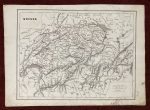
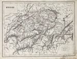
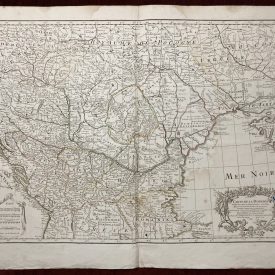
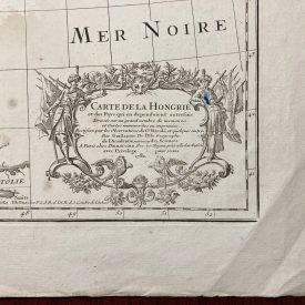
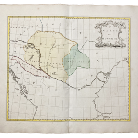
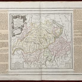
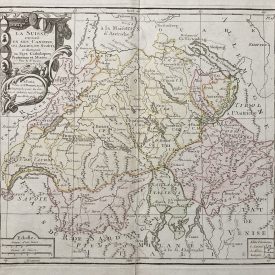
Suisse Antique Map
Antique map of Switzerland, engraved by Charles V. Monin, a renowned French publisher, and geographer. He was responsible for a number of geographical jigsaw puzzles as well as separately published maps and atlases such as the “Atlas Universel de Geographie Ancienne Et Moderne” of 1837 and the “Petit Atlas National” of 1841. Monin was a member of the Société de Géographie in Paris and has also worked with other publishers of French maps including
Vuillemin and Fremin.
***
Dimensions: 330 x 235 mm; 13 x 9.2 inches (approx)
Year: ca 1850
Author: Charles V. Monin
Publisher: Unknown
Technique: Steel engraving
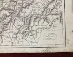
Condition: Some mold stains, particularly in the bottom right corner, some signs of paper restoration, in good condition.
***
Item will be shipped in a cardboard tube.
For other details of item condition, please see the photos. More photos available on demand. If you have any questions, feel free to contact us.
This is an original antique map. We don’t sell reproductions.