Lot of 12 Pilot Charts of the Central American Waters
***
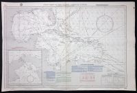
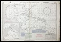
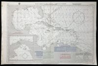
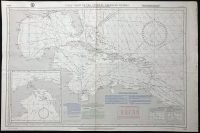
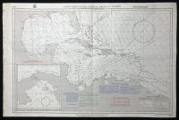
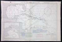
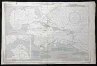
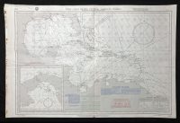
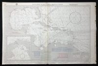
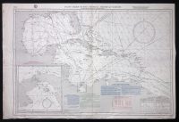
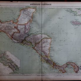
Lot of 12 pilot charts on 6 sheets of the Central American waters, showing wind roses and ocean currents, along with storm tracks for each month. The charts show Cuba, Hispaniola, Puerto Rico, Bahamas, Guadalupe, and Martinique with the surrounding Central American coast. Published by the Defense Mapping Agency Hydrographic Center in Washington.
***
Dimensions: 96 x 64 cm
Year: [1982]
Publisher: DMAHTC
Provenance: Pilot Charts Atlas
Country of manufacture: United States
Place of publication: Washington
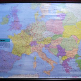
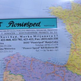
Condition: Signs of folding, light staining, rust-stained holes on one edge from binding. Some of the charts are slightly crumpled on the edges. For reference, please see the pictures.
***
The item will be shipped in a cardboard tube.
For other details of the item’s condition, please see the photos. More photos are available on demand. If you have any questions, feel free to contact us.