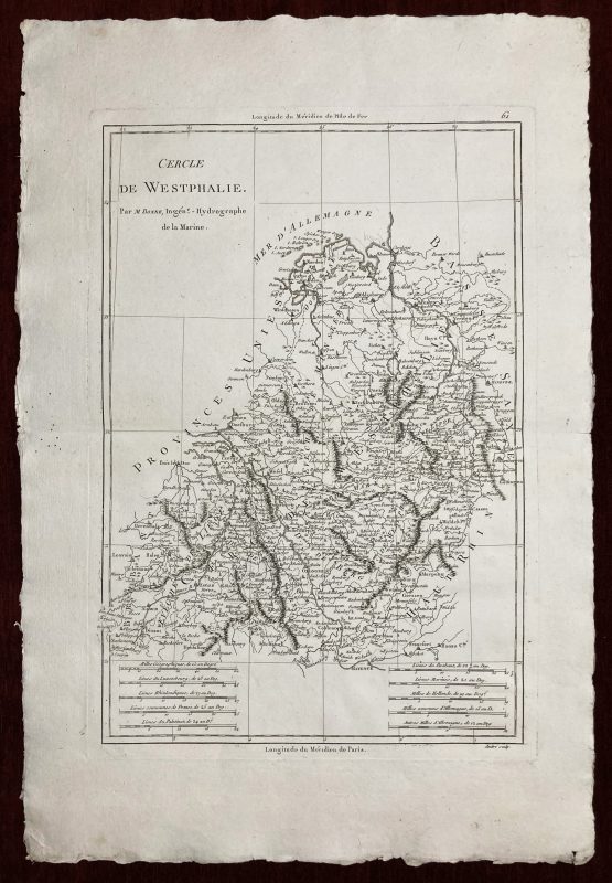
Cercle de Westphalie
Par. M. Bonne, Ingenieur-Hydrographe de la Marine.
***
Original antique map of Westphalia in northwest Germany, showcasing the region in exceptional detail.
***
Cartographer: Bonne, Rigobert
Considered one of the most significant cartographers of the late 18th century, Rigobert Bonne (6 October 1727 – 2 September 1794) held the position of Royal Cartographer to France at the Depôt de la Marine after succeeding Jacques Nicolas Bellin in 1773. In his official capacity, he meticulously compiled some of the most precise and accurate maps of the era, representing a crucial shift in cartographic ideology from the decorative style of the 17th and early 18th centuries to a more practical and detail-oriented approach. Though mainly focusing on coastal regions, Bonne’s work is esteemed for its historical significance, meticulous detail, and appealing aesthetic.
From: Atlas encyclopedique: contenant la géographie ancienne, et quelques cartes sur la géographie du moyen age, la geographie moderne, et les cartes relatives a la géographie physique
***
Technique: Copperplate
Year: 1787
Size: 46 x 32 cm; 35 x 25 cm (print)
Condition: Folded as issued, uncut, 6 holes less than 0,5mm not affecting the print. Perfect for framing.
***
For details on the condition, please see the pictures. If you have any questions, feel free to contact us.