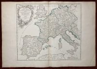
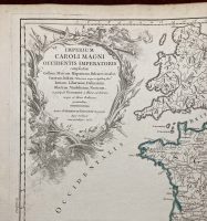
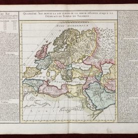
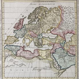
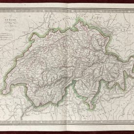
Original Antique Map of Europe
Imperium Caroli Magni Occidentis Imperatoris
***
Author: Robert de Vaugondy
Technique: Copperplate
Dimensions (approximately): 56 x 48 cm, 22 x 19 inches
Year: 1752
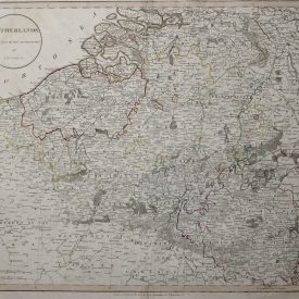
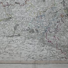
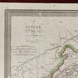
Condition: Minor tears along the line of folding, signs of restoration, minor imperfections.
***
Attractive and detailed map of Charlemagne’s empire, covering the British Isles, Denmark, the Low Countries, Germany, France, Spain, Switzerland, Austria, Italy, Hungary, Poland, the Balkans, Greece, etc. Large Decorative cartouche. Partially colored. Folding map.
***
For other details and the item’s condition see the photos. If you have any questions, feel free to contact us.
***
Note:
This is an original antique engraving. We don’t sell reproductions.
The item will be shipped in a cardboard tube.