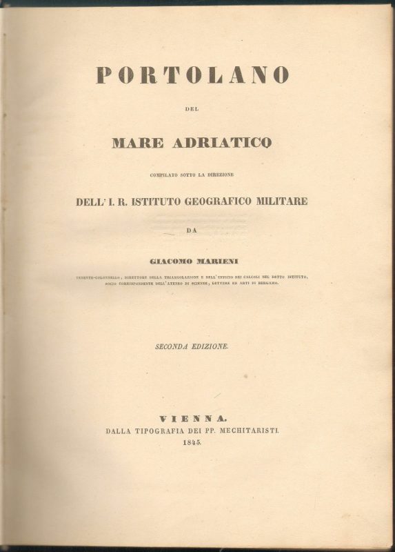

Portolano del Mare Adriaticocompilato sotto la direzione dell’ I.R. Instituto Geografico Militare Marinei Giacomo
***
(Pilot Book of the Adriatic sea) – In the Italian language. Second revised edition.
***
Vienna, Tipografia dei PP. Mechiraristi, 1845.
***
Pp.: XIV + 33-546.
Size: 33,4 x 24,3 cm.
***
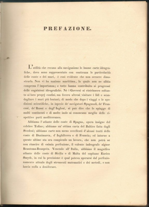
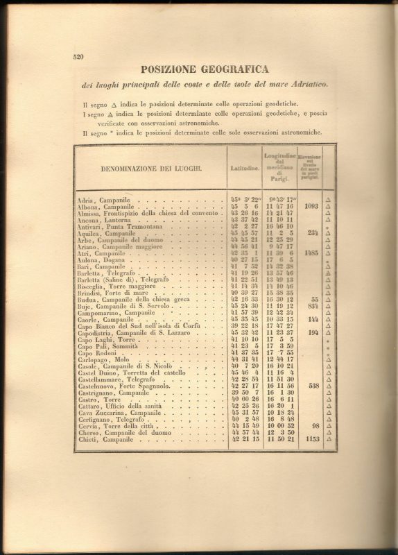
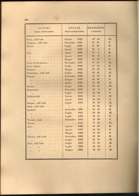
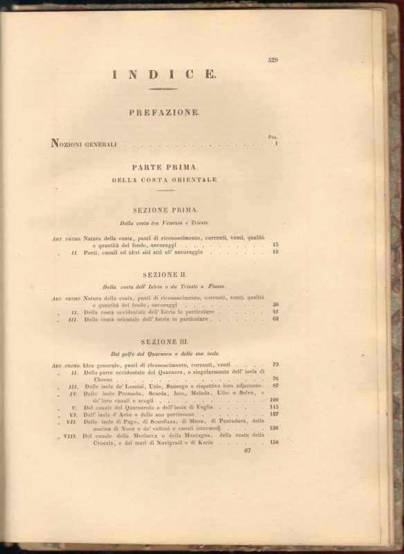
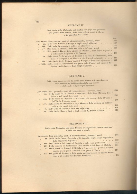
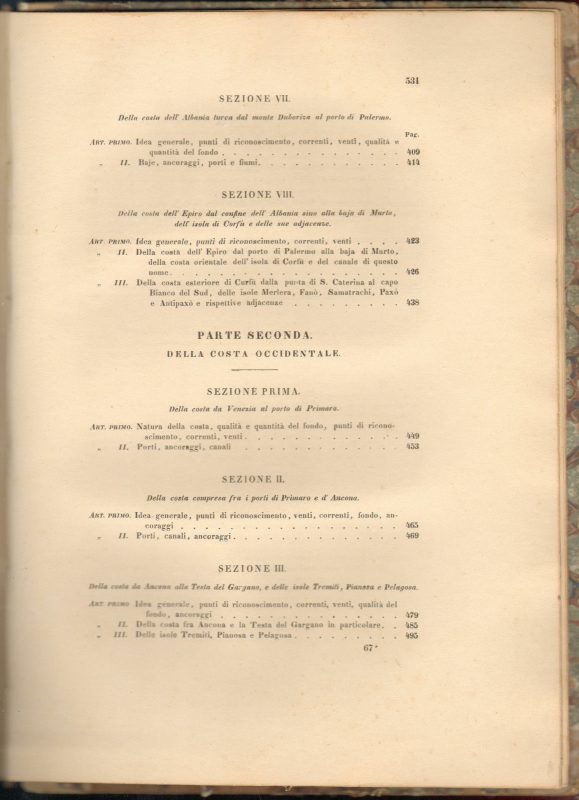
Marinei’s Portolano de mare Adriatico is considered the first pilot book made of the Adriatic Sea. Here we have the second and revised edition used as the most detailed and accurate marine pilot books of the 19th century. One of few remaining copies of one of the indispensable tools for navigating the Adriatic sea. The latitude and longitude of hundreds of coastal places and islands are indicated. The coasts between Venice and Trieste, Istria, Quarnaro, Dalmatia, Albania, Epirus are then described. the part between Venice and the Port of Primaro and up to Ancona, then from Ancona to the Gargano, the Tremiti, Pianosa, and Pelagosa and up to S. Maria di Leuca ITA Kvarner, Dalmatia, Albania, Epirus. the part between Venice and the Port of Primaro and up to Ancona, then from Ancona to the Gargano, the Tremiti, Pianosa, and Pelagosa and up to S. Maria di Leuca
***
Binding: Original half vellum binding with marbled covers. Signs of handling, marbled paper damaged, parts missing. Very small parts of the spine missing. Flyleafs browned and spotted with very small defects. of aging and minor stains, traces of erased stamp of the previous owner on flyleaf.
Condition: Pages 1-32 missing (photocopies attached). Signature of the previous owner on the half-title. Nice and clean with a very few minor stains within the text block. Printed on very strong paper with wide margins.
***
For item condition and details see the scans. More photos are available on demand. If you have any additional questions, feel free to contact us, we are eager to respond.
***