Blog
Old Maps of Africa – Slave Coast
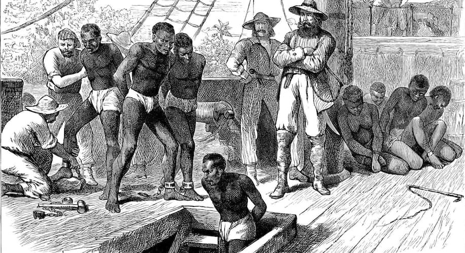
Slave Coast of Africa
The Slave Coast of Africa is a historical name representing coastal parts of West Africa. This region was a main source of slaves during the Atlantic slave trade which lasted from the 16th to 19th century. Between 1525 and 1866, 12.5 million Africans were shipped to North America, the Caribbean, and South America, according to the Trans-Atlantic Slave Trade Database. More than 2 million died during that dreadful journey under bondage in the slave ships.
The horrors that the Africans were suffering had their own mark on culture and heritage, especially in the United States. Naturally, the slave trade was facilitated by large colonial forces: the Portuguese, the Dutch, and the British. Millions of people were traded to New World to work on coffee, cocoa, and cotton plantations. Some of them worked in gold and silver mines in terrible conditions. The “lucky ones” were hired as domestic servants. Before they were sent on this deadly journey to the New World, the Africans were kept in numerous forts along the coastline.
Slave Forts
The European colonists built over 30 so-called slave forts. during the period that spans over 200 years. You can imagine the conditions in which slaves were held. Without water or sanitation, the floor of the dungeon was littered with human waste and many captives fell seriously ill. The men were separated from the women, and the captors regularly raped the helpless women. The castle also featured confinement cells — small pitch-black spaces for prisoners who revolted or were seen as rebellious. Once the slaves set foot in the castle, they could spend up to three months in captivity under these dreadful conditions before being shipped off to the New World.
Cape Coast Castle
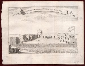
Most of the forts were built on the coast of West Africa (gold coast), which is now the territory of Ghana. One of the most notorious slave forts was Cape Coast Castle. Although it was originally built by the Swedes for the trade of timber and gold, the fort quickly became a “slave factory”. Thousands of Africans were held here before they were loaded onto ships and sold in the Americas. This place was known as “the gate of no return”, the last stop before crossing the Atlantic ocean.
Like the other slave castle, Cape Coast had an underground level and a living space above it. The underground dungeon was a space of terror and death. These walls were the Africans’ last memory before they were sent on the dreadful and possibly deadly journey across the Atlantic. If they survive terrible conditions and numerous diseases in the dungeons.
Just a couple of meters above this dark underground of terror, sickness, and death, the castle had some extravagant chambers with beautiful parquet floors and scenic views of the blue waters of the Atlantic. There was also a chapel in the castle enclosure for the officers, traders, and their families as they went about their normal day-to-day life completely detached from the unfathomable human suffering they were consciously inflicting.
Contemporary maps of slave forts
There were numerous plans and views of these forts, done by various European engravers. The engravers made these plans and views during their travels, or on written accounts of the explorers. Some of the authors are Jakob van der Schley, Jacques Nicolas Bellin, and Francois Didot. The plans and views were thorough and highly accurate, so they represent authentic and veritable memory of the history of African people.
Thanks for reading. Feel free to browse our collection of these maps
The featured photo is taken from Encyclopedia Britannica.
The photo of Cape Coast castle is from an actual listing from our store.


