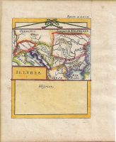
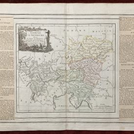
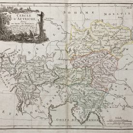
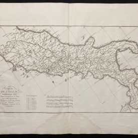
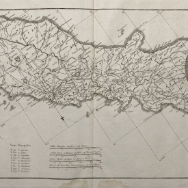
Illyriae (Illyria)
Antique map of ancient regions of Illyria and Pannonia, engraved by Alain Mallet. This map comes from the German edition of ‘Description de l’Univers’. The territories which are depicted roughly correspond with modern-day Croatia, Bosnia and Serbia with parts of neighboring countries. A prominent feature is the distinctive coastline of Dalmatia. Contemporary outline hand coloring.
***
Dimensions: 112 x 172 mm; 5.5 x 4 inches (approx)
Year: 1685
Engraver: Alain Mallet
Technique: Copperplate
Condition: Few minor stains and imperfections, in very good condition.
***
Item will be shipped in a cardboard tube.
For other details of item condition, please see the photos. More photos available on demand. If you have any questions, feel free to contact us.
This is an original antique map. We don’t sell reproductions.

")