Nautical Chart
Milne Bay Including Approaches from China and Goschen Straits
***
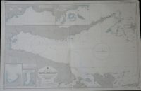
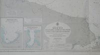
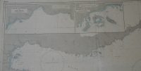
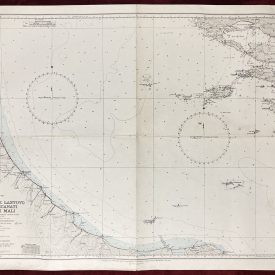
Original nautical chart of Milne Bay including approaches from China and Goschen Straits on the east coast of Papua New Guinea. The map shows the Discovery and Kana Kopi bays with Gili Gili anchorage and Killerton islands. Initially published by the Australia Hydrographic Service in 1970 under the superintendence of Captain J.H.S. Osborn. Printed by the Royal Australian Navy.
***
Dimensions: 110 x 72 cm; 43 1/2 x 28 1/2 in
Year: 1989
Publisher: Hydrographic Service R.A.N.
Country of manufacture: Australia
Place of publication: Wollongong
Condition: Folded as issued, lower corners slightly crumpled and stained.
***
The item will be shipped in a cardboard tube.
For other details of the item’s condition, please see the photos. More photos are available on demand. If you have any questions, feel free to contact us.