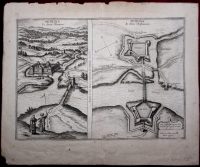
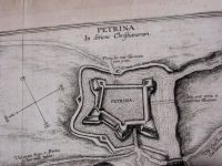
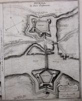
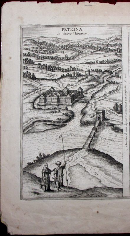
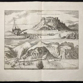
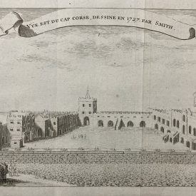
Petrina in ditione Turcarum
Antique map of Petrinja fortress in north Croatia, published in Braun’s Civitates Orbis Terrarum, in 1617. This two-view map shows Petrinja as it was during the Turkish rule, and then as it was after being recaptured and restructured. The first map (on the left) shows Petrinja after reconstruction following one of the conflicts with the Christian army. The second map image shows the renewed fortress of Petrinja. Unlike the old fortress which had a square shape, the new Petrinja fortress acquired a pentagonal form with four-sided bastions at each corner. As can be seen, the Ottomans built another fortress in the vicinity, called Husarski grad. The network of roads and bridges over the Cupa river is also indicated. The narrative of the Petrinja fortress is given on the backside.
The author of the veduta is Georg Hoefnagel, the Flemish painter and typographer. Traveling around the world, he created over 100 vedutas for monumental work Civitates Orbis Terrarum.
***
Dimensions: 580 x 480 mm; 23 x 19 inches (approx)
Year: 1617
Engraver: Georg (Joris) Hoefnagel
Technique: Copperplate
Condition: Creases and tears along the edges of the print, some stains, inscription in the bottom right corner, signs of restoration on the back.
***
Item will be shipped in a cardboard tube.
For other details and item condition, please see the photos. More photos available on demand. If you have any questions, feel free to contact us.
This is an original antique map. We don’t sell reproductions.