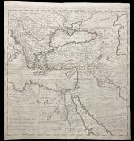
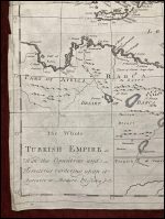
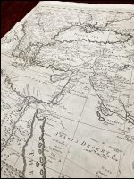
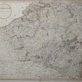
The Whole Turkish Empire with the countries and terretories bordering upon it agreable to modern history
An antique 18th-century map of the Turkish Empire and bordering countries. It was engraved by Herman Moll, and printed in 1744 in London.
***
Dimensions: 45 x 46 cm
Year: 1744
Engraver: Herman Moll
Publisher: T. Longman
Place Of Publication: London
Technique: Copperplate
Condition: Some lines of folding, the map is a bit stained along the edges. Good; suitable for framing. Please check the scan for any blemishes prior to making your purchase. Virtually all antiquarian maps and prints are subject to some normal aging due to use and time which is not obtrusive unless otherwise stated. We offer a no-questions-asked return policy.
***
The item will be shipped in a cardboard tube.
For other details of item condition, please see the photos. More photos are available on demand. If you have any questions, feel free to contact us.
This is an original antique map. We don’t sell reproductions.