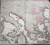
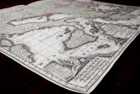
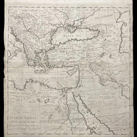
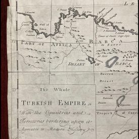
Theatrum Belli Sive Novissima Tabula Qua Maxima Pars Danubii Et Præsertim Hungaria Cum Aliis Adiacentibus Regnis; Nec Non Græcia, Morea, Et Archipelagi Insulæ Accurate Delineantur
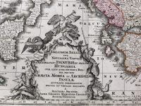
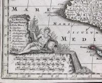
Decorative map of Greece, Hungary, the Balkans, and the Eastern Mediterranean, including Sicily and Malta. From Seutter Theatrum Belli. Decorated with two stunning cartouches. The title cartouche has a dramatic scene of battle topped with allegorical figures. A river god sits atop the scale of miles to the left. Beautiful full-color example. Engraved by Matthaus Seutter, a prominent German mapmaker in the mid-eighteenth century.
***
Dimensions: 575 x 495 mm; 19.5 x 22.5 inches (approx)
Year: ca 1750
Engraver: Matthaus Seutter
Technique: Copperplate
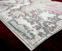
Condition: Line of folding, in excellent condition otherwise.
***
Item will be shipped in a cardboard tube.
For other details of item condition, please see the photos. More photos available on demand. If you have any questions, feel free to contact us.
This is an original antique map. We don’t sell reproductions.