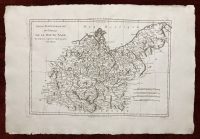


Saxony Antique Map Germany 1787 Rigobert Bonne Copperplate
| Country/Region | Germany |
|---|---|
| City | Paris |
| Date Range | 1700-1799 |
| Format | Atlas Map |
| Original/Reproduction | Original |
| Type | Map |
| Printing Technique | Copperplate |
| Cartographer/Publisher | Rigobert Bonne |
| Year | 1787 |
$60.00
In stock
Antique Map of Saxony in Germany
***
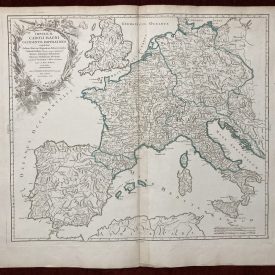
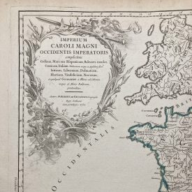
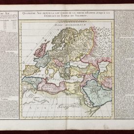
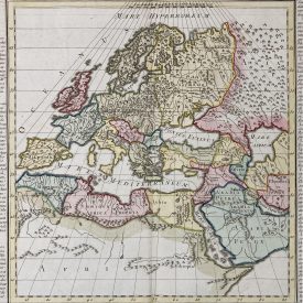
Exceptionally detailed original antique map of the Upper Saxony by Rigobert Bonne showcasing the region, spanning from Lower Saxony to Prussia on the right and from the Baltic coast to Lusatia in the south.
***
Cartographer: Bonne, Rigobert
Considered one of the most significant cartographers of the late 18th century, Rigobert Bonne (6 October 1727 – 2 September 1794) held the position of Royal Cartographer to France at the Depôt de la Marine after succeeding Jacques Nicolas Bellin in 1773. In his official capacity, he meticulously compiled some of the most precise and accurate maps of the era, representing a crucial shift in cartographic ideology from the decorative style of the 17th and early 18th centuries to a more practical and detail-oriented approach. Though mainly focusing on coastal regions, Bonne’s work is esteemed for its historical significance, meticulous detail, and appealing aesthetic.
From: Atlas encyclopedique: contenant la géographie ancienne, et quelques cartes sur la géographie du moyen age, la geographie moderne, et les cartes relatives a la géographie physique
***
Technique: Copperplate
Year: 1787
Size: 46 x 32 cm; 35 x 25 cm (print)
Condition: A few minor imperfections; in excellent condition overall. Perfect for framing.
***
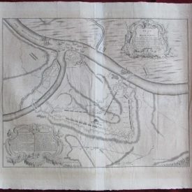
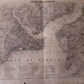
Please see the pictures for details on the condition. If you have any questions, feel free to contact us.
Payment
Payment processing options:
- Credit/Debit Card
- Paypal
- Bank transfers - SEPA (€), ACH (us$), BACS (£)-
- Credit/Debit card
- Cryptocurrencies
- AliPay
- WeChat Pay
We kindly ask our buyers to pay within three working days. In case you are having issues with payment, please contact us to let us know.
All invoices are sent electronically, we can also provide physical copies upon request.
Shipping
Shipping method:
All items are shipped via registered priority airmail. In other words, you will receive a tracking number with whom you can trace the book’s location at any given time. In case you want another carrier like UPS, DHL or other, please notify before payment.
Packaging:
Books - shipped in reinforced cardboard packages and plastic foil to protect the package from moisture damage.
Posters, maps, prints, drawings and similar - strong cardboard tubes.
Everything else - unless otherwise specified, items will be sent in envelopes reinforced on one side with cardboard and foil.
Combined Shipping:
It is possible to combine purchases. Since we don’t charge shipping for books, you don’t need to make request a separate invoice.
Please note: If you have ordered more than one item from a different category, please wait for the combined shipping invoice.
Shipping time:
We send all items within 24h of received payment received on a working day. In case we are on holidays (state, religious, personal or other) the item will be shipped the first next working day.
Post offices sometimes need up to 48h to process the tracking number. Usually all tracking numbers will be visible by then.
Delivery time:
Please note, delays due to customs office inspections are not included in the estimate.
Europe(incl Russia): 5-20 days.
North America: 15-30 days.
USA: 20-50 days.
South & Central America: 15-45 days.
Australia & Oceania: 20-50 days.
Africa: 15-40 days.
Customs office:
You may be charged by the customs office in your country. There are no hidden expenses like sales or export taxes unless specified in the item’s description. Please familiarize with the import laws of your country before purchase in case you are not entirely sure if an item subject to customs taxes. For some items an export license is needed and additional fees and time to get the export permit will be clearly stated in the item description.
Some items may end up at customs inspections on departure so we will kindly ask you to be patient while such inspections take place because they can cause a delay in the delivery time.
Also there is a possibility that some item may end at customs inspection in your country. Sometimes it’s a lengthy process, especially for buyers from the US, Italy, France and Brazil.
Returns and refunds
In case you would like to return/exchange the item for any reason you are free to do so. We ask all our buyers to contact us prior to sending an item back. The moment the item arrives back the buyer will be entitled to a refund minus the expenses for shipping and a 15% restocking fee.
Exchange for another item from the store is also an option. It is possible to return an item within 30 days from the date of arrival.
Feel free to contact us if you have any additional questions, we will be happy to answer them!