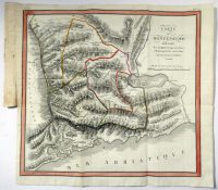
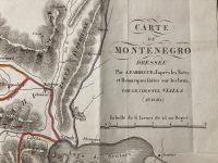
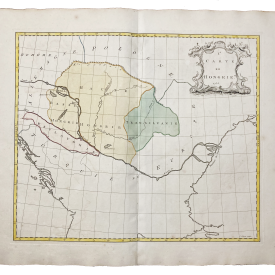
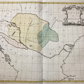
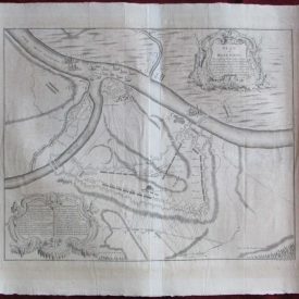
Carte du Montenegro by Jacques-Louis Vialla 1820
***
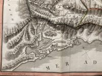
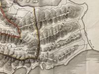
A copperplate topographical map showing the territory of Montenegro divided into nahije. The territory shown on the map stretches from the delta of the Bojana river to the entrance of the Bay of Kotor and to the course of river Moraca. Sections of Herzegovina are also visible on the map. Scale with French lеаgues is shown under the title of the map. Watercoloured.
From the Historical and political voyage to Montenegro, containing the origin of the Montenegrins (original title: Voyage historique et politique au Montenegro, contenant l’origine des Monténégrins). The map was a part of the travelogue based on the notes of Jacques-Louis Vialla, a French colonel stationed in Kotor during the French occupation of Dalmatia, during Napoleonic Wars, in the period between 1806 and 1812.
***
Dimensions: 50 x 44 cm; 19.6 x 17.3 inches
Year: 1820
Engraver: BERTHE, Rue St. Jacques No. 66.
Publisher: Еymery
Place Of Publication: Paris, France
Technique: Copperplate
Condition: Folded as issued, smaller hole in one of the creases, smaller tearing in the middle of the left edge.
***
The item will be shipped in a cardboard tube.
For other details of item condition, please see the photos. More photos are available on demand. If you have any questions, feel free to contact us.
This is an original antique map. We don’t sell reproductions.