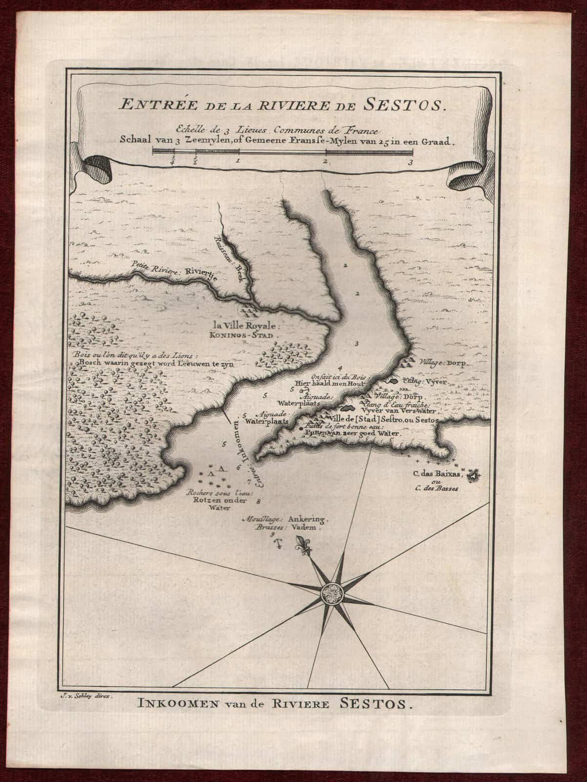
c1760 CESTOS RIVER LIBERIA ANTIQUE MAP ENTREE DE LA RIVIERE DE SESTO BELLIN
Original Antique Map
Entree de la Riviere de Sestos
***
Dimensions: 260 x 190 mm, 10.2 x 7.5 inches
Period: CA 1764
***
The Cestos River is a Liberian river that rises in the Nimba Range of Guinea and flows south along the Côte d’Ivoire border, then southwest through tracks of Liberian rain forest to empty into a bay on the Atlantic Ocean where the city River Cess is located. The Pygmy Hippopotamus (Choeropsis liberiensis) is known to inhabit lands along stretches of the river. It forms the northern third of the international boundary between Liberia and Côte d’Ivoire.
***
Condition: Slightly wrinkled, in good condition.
***
For other details and condition see the scans. If you have any questions, feel free to contact us.
***
Note:
This is an original antique map. We don’t sell reproductions.
Item will be shipped in cardboard tube.

