Nautical Chart
Ports and Anchorages on the Yugoslavian Coast II
***
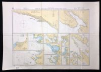
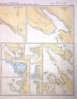
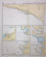
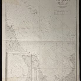
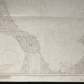
Nautical chart of the ports and anchorages of the Yugoslavian coast in the Adriatic Sea, showing: Rijeka, Bakarski zaliv, Koper, Novigrad, Pula, Vršar and more. Published by the Federal Maritime and Hydrographic Agency of Germany, in Hamburg, 1987.
***
Dimensions: 125 x 89 cm
Year: 1987
Publisher: Federal Maritime and Hydrographic Agency of Germany
Country of manufacture: Germany
Place of publication: Hamburg
Condition: Folded as issued, minor wrinkling, light staining on the lower edge, inscribed on back with marker.
***
The item will be shipped in a cardboard tube.
For other details of the item’s condition, please see the photos. More photos are available on demand. If you have any questions, feel free to contact us.