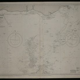
Nautical Chart of Hay Point to Penrith Island
***
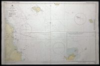
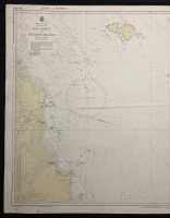
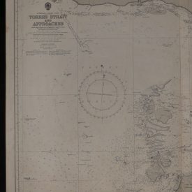
Nautical chart of Hay Point to Penrith Island in Queensland, on the east coast of Australia. Published and printed in 1971 by Hydrographic Service R.A.N. under the superintendence of admiral J. H. S. Osborn. The chart includes Mackay Harbour and Cumberland Islands showing depths, nature of the sea floor, hazards, aids to navigation, tides, and currents, with some topographic detail of the adjoining coasts. Depths and heights are in meters.
***
Publisher
The Australian Hydrographic Service (formerly known as the Royal Australian Navy Hydrographic Service) is the Australian Commonwealth Government agency responsible for providing hydrographic services that meet Australia’s obligations under the SOLAS convention and the national interest; enabling safe navigation, maritime trade, and supporting the protection of the marine environment. The agency, headquartered at the Australian Hydrographic Office in Wollongong, New South Wales, is an element of the Royal Australian Navy (RAN) and serves both military and civilian functions.
***
Dimensions: 109 x 70 cm; 43 x 27 in
Year: 1971
Publisher: Hydrographic Service R.A.N.
Country of manufacture: Australia
Place of publication: Sydney
Author: J. H. S. Osborn
Condition: Signs of folding, light stains near the edges, smaller tears (up to 1cm) at the start of folding lines.
***
The item will be shipped in a cardboard tube.
For other details of item condition, please see the photos. More photos are available on demand. If you have any questions, feel free to contact us.