1928 Dalmatien Narenta-Kanal Nautical Map Adriatic Sea Neretva Chanel Strait Rare
Original Antique Nautical Map
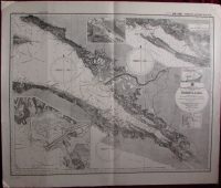
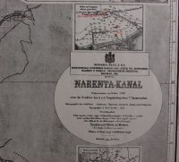
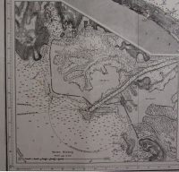
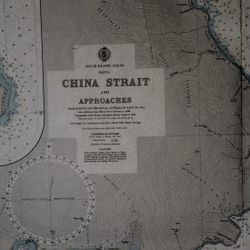
Dalmatien. Narenta-Kanal [mit Nebenkarten: Mündung der Narenta (1:28 800), Enge bei Stagno piccolo (1:28 800), Bucht von Klek (1:28 800)]
By Military Geographic Institute of Kingdom of Serbs, Croats and Slovenes in Belgrade
***
Scale: 1 : 80.000
Dimensions: 715 x 600 mm, 28 x 23 inches
Year: 1928
***
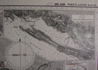
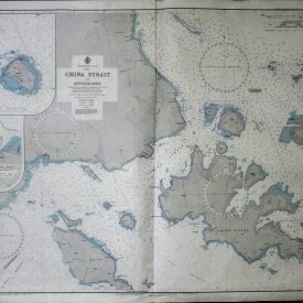
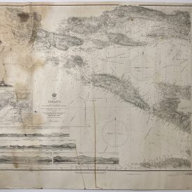
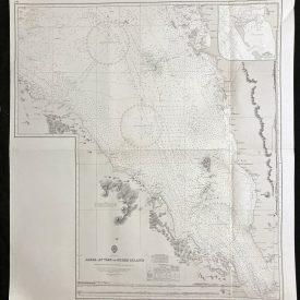
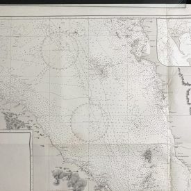
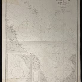
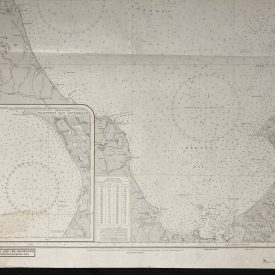
Extremely rare nautical map showing the section of Adriatic Sea, centered on the Strait of Neretva. Strait of Neretva is located between the southeastern part of the island of Hvar and the coast of the mainland. In the southeastern part of the Neretva canal, between the mainland and Peljesac, there is the Little Sea area, and further to the southeast is the Bay of Maloston.
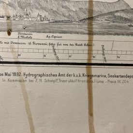
Map itself is very detailed and accurate, it’s showing sea depth in various locations and all most important ports. Map includes three inset maps listed in the title and three compass roses. The map is based on nautical map printed in 1869 for the needs of Austro-Hungarian navy. Issued as No. 6341.
***
Condition: Line of folding along the middle of the map. Contemporary inscriptions on the map, presumably made by the members of Royal Navy. Overall in good condition.
***
For other details and condition see the scans. If you have any questions, feel free to contact us.
***
Note:
This is an original antique engraving. We don’t sell reproductions.
Item will be shipped in cardboard tube.