Antique Map of Austria
Original Antique Copperplate
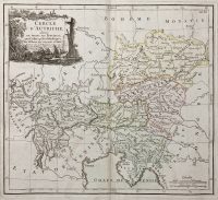
Cercle d’Autriche
***
Dimensions (approximately): 50,5 x 33,5 mm, 20 x 13 inches
Year: 1766
***
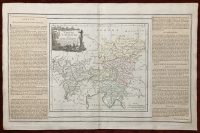
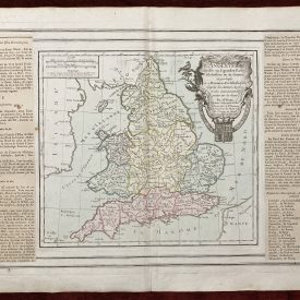
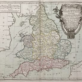
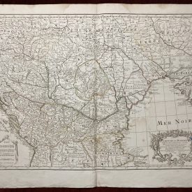
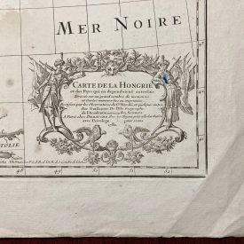
Antique eighteenth-century copperplate atlas map with original hand color. The flanking columns of descriptive text were stuck onto the sheet at publication. The map shows the territory of Austria under the Holy Roman Empire. It covers from Lake Constance eastward to Hungary and south as far as the Adriatic Sea. The Circle of Austria was, as shown here, bordered by Swabia, Bavaria, Bohemia, and Moravia to the North, Switzerland on the west, the Venetian States and the Adriatic to the south, and Croatia and Hungary to the east.
The map includes Vienna, the traditional seat of the House of Habsburg and, usually, the Holy Roman Emperor. The ‘circle’ in the map’s title refers to an ‘imperial circle,’ one of the administrative units created primarily for tax and defense purposes by the Holy Roman Empire. Of course, the Napoleonic Wars would dissolve the Holy Roman Empire and consolidate Germany in 1871, with a separate Austria.
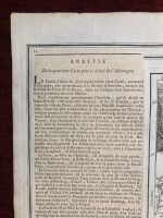
From “Atlas General méthodique et élémentaire, pour l’étude de la géographie et de l’histoire moderne”. Folding map.
***
Condition: Signs of folding. It has a few minor imperfections and stains but is in good condition overall.
Artist: Louis Desnos
***
For details of the item’s condition, please refer to the images. If you have any questions, feel free to contact us.